Given the size of the town, there isn’t a large online presence on the internet. Most businesses and services communicate and relate to one another via WhatsApp and WhatsApp Groups. In light of this, the directory below was created in the hope of getting the town ‘more online’. Permission has been sought from the various businesses and services in order to have them listed here in the links below:
Related Links pertaining to Springfontein below:
Main Page about Springfontein
Springfontein Business Directory
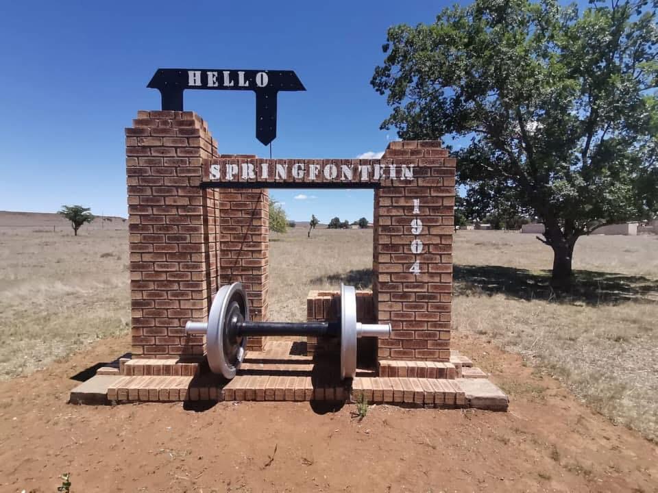
Image Source and by Courtesy of: Serijke Grobler
Springfontein is a small, historically significant mixed‑farming town in the southern Free State, known for its railway heritage, Anglo‑Boer War sites, and wide open semi‑arid landscapes. Below is a deep, structured summary synthesizing authoritative sources.
🌍 Location & Geographic Setting
Terrain & Vegetation
The landscape consists of flat to gently rolling plains, transitioning between grassland and Karoo‑type shrubland, with wide horizons and sparse tree cover.
Origin of the Town Name
The name comes from the original farm “Springfontein”, referring to a strong natural spring (“spring fountain” in Afrikaans) that historically supplied water to the area.
🚆 Connectivity & Transport Importance
Railway Junction History
Springfontein developed as a major railway junction, connecting Bloemfontein, Johannesburg, Port Elizabeth, East London, and western Free State towns like Koffiefontein and Fauresmith.
Road Access via the N1
The town lies directly on the N1 national highway, the main north–south route through South Africa, giving it strategic transport relevance.
Decline of Rail Use
Rail activity has decreased significantly in recent decades, leaving the station functional but quiet, with freight movement far lower than in its historical peak.
👥 Population & Demographics
Population Size
The 2011 census recorded 3,699 residents in Springfontein.
Racial Composition
- Black African: 75.1%
- Coloured: 21.1%
- White: 3.1%
- Indian/Asian: 0.5%
Language Distribution
- Xhosa: 41.5%
- Afrikaans: 28.9%
- Sotho: 22.8%
- Tswana: 3.1%
Municipal Classification
Springfontein forms part of the Kopanong Local Municipality within the Xhariep District.
🌦 Climate & Environment
Temperature Range
Summers reach 28–29°C, while winter nights often drop below 0°C, with regular frost.
Rainfall Patterns
Annual rainfall averages ~440 mm, mostly from summer thunderstorms.
Seasonal Characteristics
Winters are dry, crisp, and cold; summers are warm with scattered storms.
Drought Tendencies
The region experiences periodic droughts, typical of the southern Free State’s semi‑arid climate.
🐑 Economy & Land Use
Agricultural Activities
The area supports sheep farming, cattle farming, and maize production, forming the backbone of the local economy.
Historical Industries
The Springfontein Creameries were once a major employer and economic driver.
Current Economic Role
Today the town functions as an agricultural service centre and a residential hub for surrounding farms, with modest commercial activity.
🕰 Historical Significance
Anglo‑Boer War Camp
In 1901, the British established a concentration camp east of Springfontein.
It held Boer civilians and later Black detainees from Thaba’Nchu.
Conditions were harsh, worsened by a snowstorm, and 704 people—mostly children—died.
Two cemeteries remain, including one for unbaptized children.
Emily Hobhouse’s Involvement
Humanitarian reformer Emily Hobhouse stayed at De Bome House while investigating camp conditions and advocating for better treatment.
British Blockhouses
Remnants of British blockhouses near the railway line mark Springfontein’s strategic importance during the war.
San Rock Engravings
The area contains San rock engravings estimated to be around 1,000 years old, adding archaeological depth to the region.
🏘 Town Layout & Infrastructure
Residential Structure
The town has a central grid layout with large erven (often 1,000–3,000 m²), typical of rural Free State towns.
Business & Services Zone
A small business strip provides essential services, shops, and municipal offices.
Railway Station Area
The station area includes old rail buildings, sidings, and historical infrastructure from its junction era.
Township Layout
Outlying township areas provide most of the town’s housing, with a mix of formal and informal structures.
Municipal Infrastructure
Springfontein has municipal water, electricity (Eskom/municipal), sewerage systems, tarred main roads, and gravel side streets.
🛡 Safety & Social Profile
Crime Patterns
Crime is generally low to moderate, mostly interpersonal rather than organized.
Community Dynamics
The town has a quiet rural character, with strong community ties and typical small‑town social rhythms.
🎨 Cultural & Natural Attractions
Concentration Camp Cemeteries
Two cemeteries commemorate Boer and British war victims, including a children’s cemetery.
Rock Art Sites
San engravings offer insight into early inhabitants of the region.
Great Trek Memorials
Ox‑wagon tracks and memorials reflect early settler movement through the area.
Landscape‑Based Activities
The open plains suit photography, walking, birdwatching, and quiet outdoor recreation.
Related Links Pertaining to Springfontein:
Given the size of the town, there isn’t a large online presence on the internet. Most businesses and services communicate and relate to one another via WhatsApp and WhatsApp Groups. In light of this, the directory below was created in the hope of getting the town ‘more online’. Permission has been sought from the various businesses and services in order to have them listed here below:
Main Page about Springfontein
Springfontein Business Directory
Did you know?
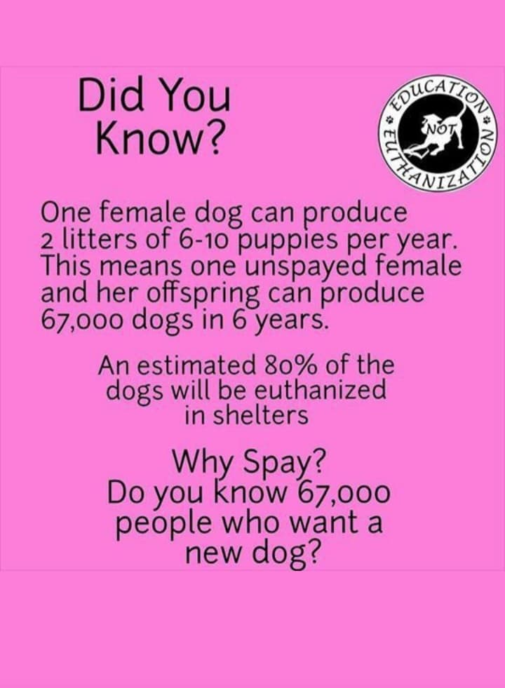
The only way to reduce the suffering of innocent dogs and cats is to control the ongoing backyard breeding. Simple : too many and not enough good homes.
A note: The issue is not just that a mother dog can produce many offspring that end up unwanted and uncared for and end up suffering, with not enough homes to care for them. If one even has a heart, it is simply not right ethically and morally to use a female dog for this purpose alone. IT IS WRONG and frankly evil!!! The fact that one ‘owns’ a dog does not give one the right to treat female dogs in this manner either. You WILL be prosecuted to the full extend of the law if you are caught and found out!